Lamar, Arkansas
Lamar, Arkansas | |
|---|---|
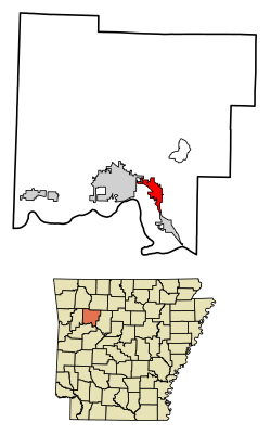
 Location of Lamar in Johnson County, Arkansas | |
| Coordinates: 35°26′37″N 93°23′42″W / 35.44361°N 93.39500°W | |
| Country | United States |
| State | Arkansas |
| County | Johnson |
| Area | |
• Total | 4.64 sq mi (12.03 km2) |
| • Land | 4.62 sq mi (11.95 km2) |
| • Water | 0.03 sq mi (0.07 km2) |
| Elevation | 430 ft (130 m) |
| Population (2020) | |
• Total | 1,719 |
| • Density | 372.40/sq mi (143.80/km2) |
| Time zone | UTC-6 (Central (CST)) |
| • Summer (DST) | UTC-5 (CDT) |
| ZIP code | 72846 |
| Area code | 479 |
| FIPS code | 05-38290 |
| GNIS feature ID | 2404879[2] |
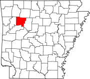
Lamar is a city in Johnson County, Arkansas, United States. The population was 1,605 at the 2010 census,[3] up from 1,415 at the 2000 census.
Geography
[edit]Lamar is located in southeastern Johnson County in the valley of Cabin Creek. U.S. Route 64 is Lamar's Main Street and leads northwest 5 miles (8 km) to Clarksville, the county seat, and south 4 miles (6 km) to Knoxville. Interstate 40 crosses US 64 2 miles (3 km) south of Lamar at Exit 64 and leads west 64 miles (103 km) to Fort Smith and southeast 19 miles (31 km) to Russellville. Little Rock is 95 miles (153 km) southeast of Lamar via I-40.
According to the United States Census Bureau, Lamar has a total area of 4.7 square miles (12.3 km2), of which 0.02 square miles (0.05 km2), or 0.38%, are water.[3]
Demographics
[edit]| Census | Pop. | Note | %± |
|---|---|---|---|
| 1900 | 474 | — | |
| 1910 | 520 | 9.7% | |
| 1920 | 542 | 4.2% | |
| 1930 | 449 | −17.2% | |
| 1940 | 474 | 5.6% | |
| 1950 | 555 | 17.1% | |
| 1960 | 514 | −7.4% | |
| 1970 | 589 | 14.6% | |
| 1980 | 708 | 20.2% | |
| 1990 | 768 | 8.5% | |
| 2000 | 1,415 | 84.2% | |
| 2010 | 1,605 | 13.4% | |
| 2020 | 1,719 | 7.1% | |
| U.S. Decennial Census[4] | |||
2020 census
[edit]| Race | Number | Percentage |
|---|---|---|
| White (non-Hispanic) | 1,401 | 81.5% |
| Black or African American (non-Hispanic) | 28 | 1.63% |
| Native American | 22 | 1.28% |
| Asian | 9 | 0.52% |
| Other/Mixed | 91 | 5.29% |
| Hispanic or Latino | 168 | 9.77% |
As of the 2020 United States census, there were 1,719 people, 747 households, and 486 families residing in the city.
2000 census
[edit]As of the census[6] of 2000, there were 1,415 people, 529 households, and 362 families residing in the city. The population density was 324.9 inhabitants per square mile (125.4/km2). There were 585 housing units at an average density of 134.3 per square mile (51.9/km2). The racial makeup of the city was 95.97% White, 0.14% Black or African American, 1.13% Native American, 0.21% Asian, 0.64% from other races, and 1.91% from two or more races. 3.46% of the population were Hispanic or Latino of any race.
There were 529 households, out of which 35.5% had children under the age of 18 living with them, 51.6% were married couples living together, 12.1% had a female householder with no husband present, and 31.4% were non-families. 28.0% of all households were made up of individuals, and 11.9% had someone living alone who was 65 years of age or older. The average household size was 2.54 and the average family size was 3.05.
In the city, the population was spread out, with 25.8% under the age of 18, 9.6% from 18 to 24, 27.4% from 25 to 44, 21.5% from 45 to 64, and 15.7% who were 65 years of age or older. The median age was 36 years. For every 100 females, there were 92.3 males. For every 100 females age 18 and over, there were 92.0 males.
The median income for a household in the city was $23,317, and the median income for a family was $27,143. Males had a median income of $23,309 versus $16,207 for females. The per capita income for the city was $11,852. About 14.8% of families and 17.7% of the population were below the poverty line, including 18.7% of those under age 18 and 15.2% of those age 65 or over.
Education
[edit]Public education for early childhood, elementary and secondary students is primarily provided by the Lamar School District, which includes:
- Lamar Elementary School, serving pre-kindergarten through grade 3.
- Lamar Middle School, serving grades 4 through 7.
- Lamar High School, serving grades 8 through 12.
Notable people
[edit]Lee Cazort, the youngest ever Speaker of the Arkansas House of Representatives and youngest ever Lieutenant Governor of Arkansas, attended public school in Lamar before moving to Fort Smith.
References
[edit]- ^ "2020 U.S. Gazetteer Files". United States Census Bureau. Retrieved October 29, 2021.
- ^ a b U.S. Geological Survey Geographic Names Information System: Lamar, Arkansas
- ^ a b "Geographic Identifiers: 2010 Census Summary File 1 (G001): Lamar city, Arkansas". American Factfinder. U.S. Census Bureau. Archived from the original on February 13, 2020. Retrieved April 24, 2018.
- ^ "Census of Population and Housing". Census.gov. Retrieved June 4, 2015.
- ^ "Explore Census Data". data.census.gov. Retrieved January 1, 2022.
- ^ "U.S. Census website". United States Census Bureau. Retrieved January 31, 2008.

